School Trip Friday – Hadrian’s Wall
In a previous School Trip Friday post, I have told the story of how it came about that I am currently home educating my 8 year old son and on a Friday we spend the day searching out our country’s wonderful rich history and geography. Now we have a few School Trip Fridays under our belt, it was time to adventure a bit further a field.
This School Trip Friday took place last week and turned out to be a School Trip Long Weekend – from Friday to Monday. We headed out through Great Dunmow and the flat Essex countryside into the Cambridgeshire Fens and then onwards and upwards to the stunning rugged beauty of Northumbria. Our destination was the iconic stone barrier running between the Solway in the west and the Tyne in the east – now known as Hadrian’s Wall. Built by the Roman Emperor, Hadrian, in the second century AD, the wall was not so much to keep out the Picts (as is the common myth) but more as a symbol to show that the Romans were here and here to stay.
We saw so much, did so much, and investigated so much that this particular School Trip Friday will have to be split into several posts. This first post is of a small part of Hadrian’s Wall near Steal Rigg.
Come join us for our School Trip Friday to Hadrian’s Wall.
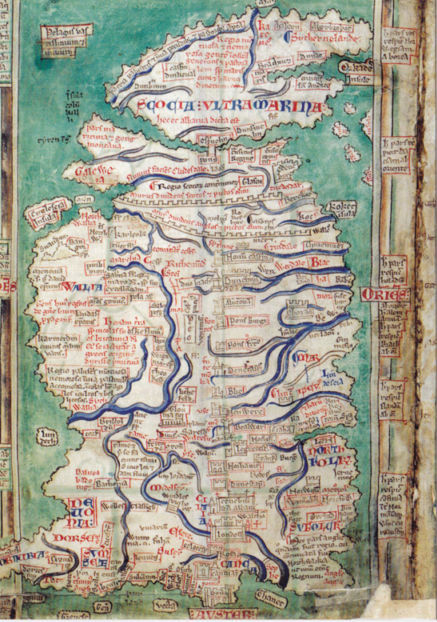 Map of Hadrians Wall and Antonine Wall (Matthew Paris c1250)
 The rugged landscape of Hadrian’s Wall running alongside Crag Lough.
 Contemplating the fact that we were down the bottom and had to be up there. Also time to explore how echoes work and how loud you have to shout to produce a magnificent rebounding sound!
 Hadrian’s Wall running off upwards into the distance. The wall becomes a reasonably modern farmer’s dry stone wall half way up, then continues on as Hadrian’s Wall.
 The long and winding road
 Hadrian’s Wall and a small fortification to the side of it.
This is not thought to be a milecastle.
 The perilous stone stairs to the top are not known as ‘Cat Stair’s for nothing. These were, in fact some of the better & safer steps on the climb. The stairs seem to be relatively modernish – I pity the person who had to build them!
 The view from the top looking down to where we once had been.
 Hadrian’s Wall snaking off into the distance. The turf on top of the wall was an early (successful) conservation attempt of the Wall by Victorian land owner, antiquarian, and town clerk, John Clayton.
 Good solid Roman engineering. Each stone perfectly shaped by hand and precisely placed into position using the same style that we see in modern-day brickwork. Built for strength and durability – the Wall has already lasted for nearly 2,000 years. What did the Romans ever do for us?…
 Tiny tiny alpine flowers growing all along the wall.
 Father and son enjoying their home education.

Today’s post is dedicated to the team at SEN Legal – whose tireless work on my son’s educational future means that ultimately he will get the correct education he so desperately needs.
In the meantime…. long live School Trip Fridays!
You may also be interested in
– School Trip Friday – Weald and Downland Open Air Museum
– School Trip Friday – Chapel of St Peter’s on the Wall, Bradwell
– School Trip Friday – Imperial War Museum Duxford
– School Trip Friday – Of Cabbages and Kings
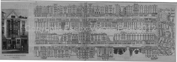 Tallis’s Street View of Bishopsgate Without.
 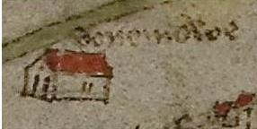 Great Dunmow (Donemowe)
